Geocaching
What is Geocaching?

At the very basic level, a geocache is container placed somewhere in the world. When speaking of terms of the geocaching hobby, it started out as ammo boxes or Tupperware containers hidden on public land. Traditionally it would contain a log book for writing your name, date, and anything else you might want to share regarding your adventure finding the cache. If the container is large enough, it was supposed to be stocked with toys or trinkets. When you found the geocache, you could take a trinket and leave another in its place. Or you could not trade trinkets at all.
 Over time, the container sizes and material became diverse. To make the hobby more interesting, people came up with cleaver ideas as to where to hide the geocache and tricky ways to get it open. There were things called 'virtual' geocaches; there was no container to find - just a place such as a stature or natural landscape worth seeing. The advent of the 'micro' geocache (old plastic film canisters and smaller) opened up the possibilities of where to hide a geocache. Many who had been in the hobby since the beginning (including me) saw this as the first downfall of quality geocache placements. A film canister could be placed at the base of a road sign or in a tiny hole of a brick wall.

The geocaching hobby continued to find other ways to keep it interesting. The 'travel bug' was invented. Its purpose was to have a geocacher move it from one geocache to another, with a particular goal in mind. 'Geocoins' were created as minted items to place in geocaches, but later because more of a collector's item to trade with others. 'Path tags', 'munzees' were offshoots of geocaching, but I won't go into details because I personally have no interest in them!
Geocache Examples - Click an image to open lightbox viewer
How I Got Started

I regularly watched a TV show called "The Screen Savers" on Tech TV station. They mentioned a new hobby called 'geocaching' where someone would hide a container in the woods, publish the coordinates, then see who would go out and find it. Originally, the idea was there would be trinkets inside that you would trade (take one out, leave a new one), sigh the logbook (a tablet of paper to prove you were physically there), then go on the internet to geocaching.com and write a not about your adventure looking for the geocache. geocaching.com keeps track of caches you look for provides personal statistics. Your log is viewable by other geocachers, which builds an on-line community.

I already owned a handheld GPS receiver (Garmin GPS III) that I attached to my bicycle when I went riding to track how far I went and where. I would copy the tracking data to my computer, overlay it on a map, then save the info to a digital file. I used this receiver to manually enter the latitude and longitude of a geocache, then follow the compass arrow to the geocache. The receiver had a map, but it was not updateable and not very detailed. Sometimes I would think the geocache was close to find out it was on the other side of a river or canyon. Instead, I printed out detailed paper maps, sometimes with terrain markings, and brought them with me.
geocaching.com

 There were a handful of internet web sites trying to be the site where you get the coordinates of geocaches and log the results of your search. The one that took hold and eventually pushed the others out was one called geocaching.com, run by an organization called GroundSpeak. At first, access to data on the web site was free. After awhile, they provided value-added services and charged an annual fee. Since I was a member of the site from the beginning, I can proudly say I am a 'charter member' since my use of the web site helped make it the definitive geocaching database web site on the internet.
Our first geocaching find
After learning where to find the coordinates of geocaches, my wife and I located the nearest one a few miles away. It was called 'Ghost' by the person who placed it there, Glenn Nash. The geocache was hidden somewhere in Route 66 State Park in Missouri. We went searching for it, but came up with a DNF ("Did Not Find"). It was somewhat of a disappointment, but we were still excited. After contacting the owner by email, he let me know it was still there. The next day we went looking for it again and found our first geocache! (Note: This is where I got my first case of chigger bites and they were really, really bad!)
I want to mention that my wife really has little interest in geocaching. She did not register a nickname with geocaching.com, makes me sign the logbook when we hunt together, and only comes along on a geocache hunt because it is good exercise in the fresh air. When she is there when the geocache is found, I sign the logbook with her unofficial geocaching name of MsE ("Miss", and 'E' for "Elaine).


Misc Geocache Hunting Photos - Click an image to open lightbox viewer
GPS receivers I have used - Click an image to open lightbox viewer
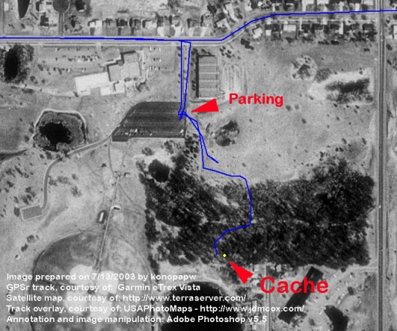
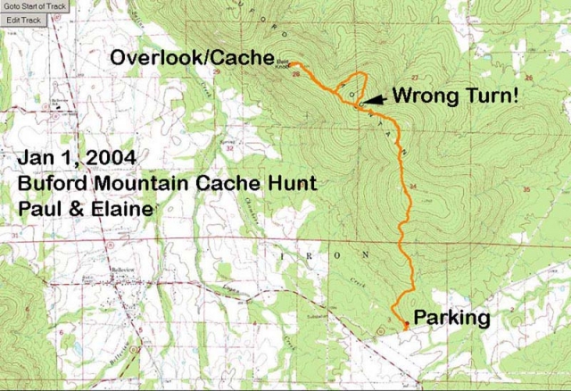
Map Overlays - Click an image to open lightbox viewer
It was fun using mapping software after returning from a geocache hunt. I could overlay waypoints and GPS tracks on a map to see where we had been. I gave this practice up after awhile because it was became too time consuming.
How It Started

SLAGA stands for the "St. Louis Area Geocachers Association". In 2001, It started as a collection of random geocachers in the St. Louis area who got in contact with each other in various ways to hunt for geocaches together and discuss the hobby. Glenn Nash (geocaching name, '*gln'), was an early adopter of the hobby. He thought there was a need to create a more formal organization. On-line discussion forums were created, followed by a web site that managed a membership database. Years later, the group file for, and obtained the status of, a 501-c7 non-profit organization.
The geocachers in the St. Louis area did not want to take on the responsibility of creating an organization to cover the entire state of Missouri. It also did not want to give itself a name that inferred it was only for people who lived in St. Louis. Most of the early members lived in the suburbs of St. Louis, surrounding Missouri counties, and on the other side of the Mississippi River in Illinois.
One of the great benefits of the organization is it schedules regular picnics, geocaching events and training. Take a look at the event photo album on this page to see the wide variety of activities it has participated in over the years. With the help of a few others, I put together a history of the SLAGA group in 2008.
SLAGA Events - Click an image to open lightbox viewer
"SLAGA Territory"
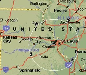
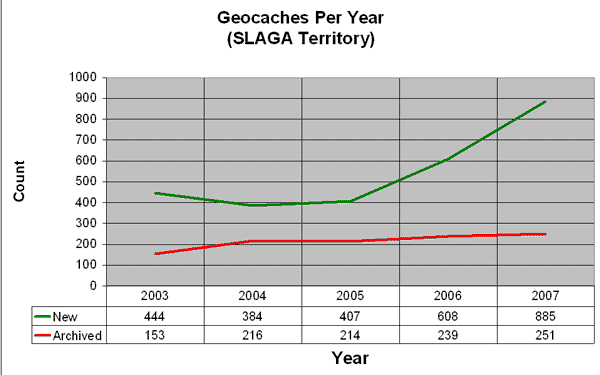
In order to not overlap the physical areas considered under the control of other geocaching groups in the United States, SLAGA arbitrarily marked a 100-mile radius around a zip code of the town of Eureka, Missouri. This was a reasonable compromise because many people who considered themselves SLAGA members lived in Jefferson City to the west, Farmington to the south, Troy to the north, and western Illinois to the east. Using that physical information, we could identify geocaches placed in "SLAGA Territory" and concentrate group communication to geocaching activities in the area.
Geocaching 101
As SLAGA matured, its members started to focus on sharing the healthy and family values of the hobby. As more and more geocaches were being placed on public land, land managers were not aware of what was going on. SLAGA wanted to take an educational stance and official group for communicating with land managers, hoping an official group would have more credence to address issues of poorly placed geocaches and better able to help create geocaching placement policies.
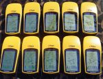
To help introduce the hobby to the general public, formal training classes were created and presented at libraries and county park buildings throughout the St. Louis area. SLAGA purchased 10 'yellow' Garmin eTrex GPS receivers so that after classroom training, students could each take a receiver, enter coordinates, and see what finding a geocache was actually like. SLAGA also created classes for geocachers to help them learn how to use different models of GPS receivers, and how to use new software being created that made it easier to upload and download geocache data.
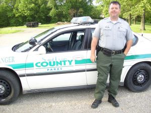
SLAGA created a Tri-fold Geocaching 101 Brochure to hand out at outdoor events it sought to participate in. Typically a booth would be set up to answer general questions and temporary geocaches were placed around the event area for the public to be guided to. A big supporter of these classes was the St. Louis County Parks Dept. SLAGA regularly did presentations for the department at public facilities. Short video clip of a class being presented at the Greensfelder County Park in 2005.
Early Days of Social Media


As the geocaching hobby grew, more and more people wanted a way to discuss interesting geocache placements. In 2001, Glenn Nash (geocaching name, '*gln') create a web page on geocaching.com for posting comments. Little by little, geocachers in the St. Louis area discovered it. It eventually had to be removed because it was making use of a web page format that was not meant for casual social discussions. Glenn then started an on-line mailing list that served the same purpose. Finally a web site was created to handle the communication of SLAGA information.
Webmaster
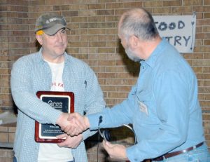
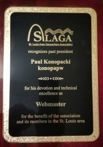
For a few years I volunteered to be the SLAGA webmaster. A small web site was set up by geocacher, Island-Dave using a domain name of 'geostl.com'. I took over the site from Dave. I taught myself Perl, CGI, PHP, HTML, JavaScript, and how to use a mySQL database. I created admin screens to allow a SLAGA membership database to be maintained. I created scheduled CRON jobs to regularly look for geocaching activity of members and caches placed in the St. Louis Area. I added an event calendar and user forum. I added a majority of content to the site related to the hobby of geocaching.
In 2010, after 7 years, I decided to spend more time on other personal projects. I turned over webmaster duties. The group obtained the domain name of 'slaga.org'. The web site lives on at http://www.slaga.org.

SLAGA Geocaching Podcast Series

About 2004, I discovered audio programs being offered on the internet. They were called 'podcasts'. I found the best life scenario for listening to them was during my work commute, working out, or when I went to bed. I did not have an mp3 player, so I was burning the audio to CD. This became tedious rather quickly. I bought myself an iRiver mp3 player because the iPod was too expensive. The iRiver had the capability to record in stereo.
It occurred to me that there were no podcasts about geocaching. I decided to create one focusing on geocaching-related activities and geocachers in the St. Louis area. I did research to determine the bare minimum equipment I would need to create, edit, and publish episodes. I learned how to edit and upload an XML metadata file containing episode info to iTunes. Since I was the SLAGA webmaster, it was easy for me to publish episodes on the internet without depending on anyone else.
Podcast Series Introduction (2:48 minutes)

From 2005 - 2008, I recorded audio from geocaching events and interviewed geocachers in the field and at my dining room table. I published a new episode once a week. I tried to keep episodes between 25 - 45 minutes because that seemed to be the sweet spot on podcast episode duration based on presumed consumer attention span and commute time. At first I provided a high-quality stereo version and a low-quality mono version of each episode. I was sensitive to the various internet download speeds my subscribers might have. But eventually I went to a single high-quality mono version.
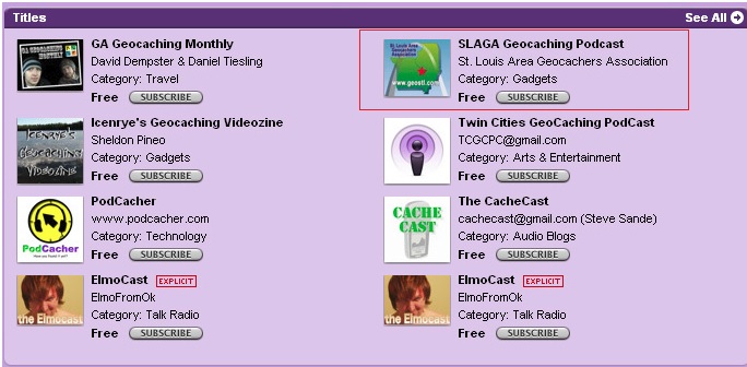
During the time I was creating podcasts, a handful of others around the country were creating their own geocaching podcast content. Occasionally I would appear as a guest on those podcasts. There was very little overlap in content because we were physically distributed around the U.S. and had different ideas as to what we wanted our podcasts to be. I decided I did not want to try to grow a following or a community around my podcasts. One geocaching podcast that started just before I created mine was 'Podcacher'. Sonny and Sandy continue to make episodes out of the San Diego area and cover geocaching topics world wide.
Episodes 1 - 100
 The SLAGA web site provides an on-line index to the podcasts. Episode #1 was audio I gathered at an event in St. Charles, Missouri where SLAGA had a booth to explain geocaching to the general public. I recorded on an iRiver mp3 player. The audio was terrible, but it was a start. I followed up by interviewing local geocachers at my dining room table where I can control of the ambient noise and could better lay out the audio equipment ahead of time. But I liked to get audio while outdoors because that is where geocaching takes place! I would attend geocaching events and grab a few people who I knew were prolific in the hobby or had interesting stories to tell. I created a poor-man's wireless microphone setup so that I could attach a microphone to the interviewee as we walked around the woods.
 I created audio podcasts at MOGA events (Midwest Open Geocaching Adventure) - (episodes #20 - #22). In order to help promote the hobby of geocaching, I had discussions with local land managers about rules and regulations of placing geocaches on public land and how the hobby promoted family values and respect for property. In 2006, I took a week-long trip by myself to Arkansas to interview geocachers in that state (episodes #36 - #41). The only phone interview I ever did was with Eric Colley - writer, director and producer of 'GPS, The Movie (episode #28). During the summer of 2008, I was approaching three years and 100 episodes. I decided to make #100 a look back at the previous episodes. I picked a few people I previously interviewed and called them up on Skype to find out where they were now and if they were still geocaching.
Podcast Equipment - Click an image to open lightbox viewer
Lone Hill Onyx Cave Story
Skip to main content
Skip to toolbar
About WordPress
My Corner
11 update available
00 Comments in moderation
New
View Page
Autoptimize
UpdraftPlus
Howdy, Paul W. Konopacki
Edit Page Add New Page
Your SiteOrigin Premium license has expired. Please renew your license to continue receiving updates and support.
If you think this is a mistake, please contact support.
Add title
Skip to Editor
Permalink: https://www.konopacki.us/geocaching/ ?
Add Widget
Add Row
Layouts
History
Live Editor
Revert to Editor
Word count: 53 Last edited by Paul W. Konopacki on September 21, 2023 at 12:26 pm
Preview Changes (opens in a new tab)
Status: Published Edit Edit status
Visibility: Public Edit Edit visibility
Revisions: 4 Browse Browse revisions
Published on: Dec 2, 2017 at 15:13 Edit Edit date and time
Duplicate This
Move to Trash
Parent
Template
Order
Need help? Use the Help tab above the screen title.
Optimize this page?
Optimize JS?
Optimize CSS?
LCP Image to preload
Set featured image
Transparent menu bar
Paul W. Konopacki, 1 year ago (September 21, 2023 @ 12:26:46)
Paul W. Konopacki, 1 year ago (September 21, 2023 @ 12:26:46)
Paul W. Konopacki, 1 year ago (September 21, 2023 @ 12:25:51)
Paul W. Konopacki, 7 years ago (January 19, 2018 @ 13:18:47) [Autosave]
Thank you for creating with WordPress.
Version 6.7.1
SiteOrigin Tabs
Widget Styles
There is a newer version of this widget's content available.RestoreDismiss
Clicking Restore will replace the current widget contents. You can revert by refreshing the page before updating.
Presets
Warning! This will override some or all of the current form values.
Title
Tabs
What is Geocaching?
How I Started
Our Hunts
SLAGA
SLAGA Podcast
Onyx Cave Story
Title
Title icon
Choose Icon
Content type
Text
Layout builder
Content
Looking Back
Add
Initially selected tab
The position of the tab to be selected when the page first loads.
Design
Tabs container
Tabs
Panels
Background color
Font
Font size
Font color
Border color
Border width
Top
Right
Bottom
Left
Border radius
Top left
Top right
Bottom right
Bottom left
Padding
Top
Right
Bottom
Left
Preview
Help
Delete Duplicate
Page Builder
Add Widget
Add Row
Layouts
Layout Builder Widget
SiteOrigin Editor
Widget Styles
Title
Add Gallery
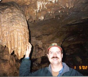
"Onyx Cave" is not only a real cave in Meramec Conservation Area in southeastern Missouri, it is the name of a geocache placed by geocachers, Steve & Connie. On January 5, 2002, Elaine (MsE), Barry (barramus), and I (konopapw) went geocaching around Meramec Conservation Area. We looked and looked, but did not find the geocache.
However, as we were looking in the rock walls around the cave entrance, I discovered a handheld Magellan GPS receiver. It had a 'property of' sticker on it. With the assumption the owner had lost it, I took it home to find out how to get the unit back to its owner. After finding a name and email address I emailed Bill Elliot, a cave biologist.


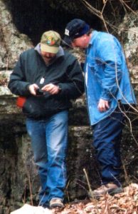
Here is an exchange of emails between Bill and me:
January 7, 2002 - Paul Konopacki (me) to Bill Elliot:
"Myself and two other 'geocachers' were poking around the Onyx cave today. I found a Magellan GPS hidden in one of the nooks to the upper right of the cave entrance. We saw the "Property of" label on it, but it wasn't until I got it home and turned it on that I saw the splash screen with your name on it (MDC Bill Elliot). I wanted to make sure it got back to the right person and I think *you* are that person! I apologize for taking it if you meant to leave it there on purpose."
January 7, 2002 - Bill Elliot to Paul Konopacki (me):
"I would appreciate it if you would mail that GPS receiver back to me right away, at the address I sent you. My field assistant, who stashed it there, has been frantic over the loss of this valuable instrument. We have various instruments located around caves, so you really should not have removed it, especially with a govt. tag on it. But, thanks for contacting me."
January 7, 2002 - Paul Konopacki (me) to Bill Elliot:
"And here I thought I was doing a good deed! A 'Property of" tag infers ownership. And within hours of finding the item, I tracked down the owner. I didn't want to leave it, on the chance that someone with selfish motives might find it and not return it. To me, "Property of" on a portable item out in the woods doesn't mean 'I left it here on purpose and if you take it you are a 'thief'. Perhaps an additional note near the item, explaining why it is there, will prevent this from happening again. When this episode is over, this story is going to make an interesting entry to my online discussion group. Please be aware that the item is intact and in fine shape."
January 7, 2002 - Bill Elliot to Paul Konopacki (me):
"Please just mail the GPS to me, as I asked. I will send you the postage in return."
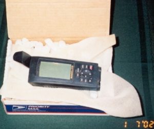
The unit was returned successfully!
The Story Is Not Over!
You might think that is the end of the story, but there are some interesting details. You see, while Elaine, Barry, and I were looking around the cave for the geocache, there were some experienced cavers exploring the cave. One of the cavers worked for Bill Elliot and had stashed the Magellan GPS in a hole in a rock. By the time the cavers emerged, we were gone, along with the GPS receiver!
January 20, 2002 - Earl Hancock (caver) to his son, Tim:
"Had another strange and comical experience beginning Jan 5; a critter count in Lone Hill Onyx Cave. Our leader hid his borrowed GPS in a nook outside the cave and when we came out it was gone. We went to a Mexican restaurant in Sullivan and tried to soothe Lawrence with Margaritas while he had to call his boss and explain the loss. His boss is Bill Elliot, Missouri's recent new Cave Specialist. The real loss was the 40 sensitive cave locations stored on the GPS. Couple days after Lawrence called saying the guy that has the GPS called Bill Elliot and thanked him for the prize. Bill goes off on the thief who will surely die at his hands. The supposed thief hangs up! * Lawrence remembers Bill calling the thief a "Geo something"??? So I tell Lawrence about geocaching."
"Good news about the GPS surfacing (if not recovered). In a phone call from Lawrence he mentioned that the finder was on a mission. Here is a link to that fast rising sport of geocaching ... Never did it myself, but looks like something I would like to do ... hike with the promise of a good outing ... maybe a treat waiting if I could find the bucket ... clean some trash along the way ... have a good time and meet some like minded friends pursuing the same reward!"
"Amazingly, the finder figures out that he had not found 'the prize' and has the decency to call Bill again, hoping Bill had calmed down!!! The data is safe and the GPS is being returned. Now I'm really curious about what this Geo hunter is going to say to his fellow hunters."
* The truth: I never called Bill or ever talked to him on the phone!
January 20, 2002 - Glenn Nash to Paul Konopacki (me):
"I have been exchanging notes with a newbie, he wants to go find a geocache. He knows about the GPS FIASCO. His name is Earl. He sent me this email:
"I've been wanting to share something with geocachers konopapw and Barramus about the Onyx Cave geocache. Perhaps you can pass my story along to them.
January 21, 2002 - Earl Hancock to Paul Konopacki (me):
"You can't know how much I've wanted to talk to you! Such sweet endings. Paul, you get the Nice Guy Award for offering to return the GPS to Bill, who probably still has not thanked you. So, the cavers of Missouri Thank You.
His assistant, as Bill calls him, is a really nice guy too. Laurence is a long time caver, raising a family, doing graduate work in Biology and trying to satisfy his lust for caving at the same time as heading up this volunteer project. In 1983 MDC paid Gene Gardner to Bio-inventory some caves under their control and then ran out of money to ever do that again. So, the cavers have stepped up to bat, for which the MDC and USFW will donate some money to the volunteer Missouri Caves and Karst Conservancy (who now own 1 cave and manage 2 others).
That was our mission at Lone Hill Onyx; eight sets of eyes peering for critters. It was a good day until Laurence discovered that Bill's GPS was missing (bad plan on his part, hiding in such an obvious and public place). He trembled at the loss and only many pitchers of Margaritas calmed him down.
Laurence said Bill had mentioned "Geo something on the phone" so I sent him links to Geocaching to help explain. And that is how Lannis and I have now found our first, and second! Yipee
Thanks again for being a nice guy. Hope we can get together for more Mr Bill stories."
Conclusion
SLAGA Geocaching Podcast interview with Earl and Lannis Hancock (3:17 minutes)

So ... we turned cavers Earl and his wife Lannis into geocachers! Since this event, we have been on a number of hikes with them and seen them at geocaching events. I even did a SLAGA geocaching podcast interview with them (see list, below). Even more ironic is that Earn and Lannis and my wife and I had mutual friends in the St. Louis area before we had met. Finally, most of the comments from people who knew Bill Elliot did not have kinds words to say about his demeanor and professionalism. Petty vindication for me, I know, but I'll take it.
Onyx Cave Story - Click an image to open lightbox viewer
Preview
Help
Delete Duplicate
Looking Back
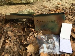
Do I still hunt geocaches? Not much these days. From 2001 - 2008 it was a consuming hobby. When my wife and I went on trips, it was scheduled around having time to find geocaches. Finding my first 1,000th geocache was a milestone because there weren't so many geocaches to find in those days. I slowed way down finding geocaches after that. I can even point out a few periods of time where I was just 'burnt out'. Now, if my wife and I take a two-day trip, we may realize when we get home we didn't even think about finding a geocache. Or we just hunt for geocaches hidden in highway rest stops because we are more concerned with getting to our destination than spending time roaming through the woods. My favorite kind of geocache hide is still one hidden deep in the woods that might require a 5-mile hike.
geocaching.com find statistics for geocacher 'konopapw' as of 12/13/2017

How Has the Hobby Changed?


As the hobby became more popular in the early 2000s, hiding places because less impressive. People were not necessarily looking for interesting places to hide a geocache. They were hiding them under lamppost skirts in parking lots (without permission) and at the bottom of random street signs along busy highways. People who did not know what the hobby was might consider the geocache they accidentally found in the woods was trash and throw it away. Casual geocachers might place a geocache and then not maintain it (dry it out if the contents get wet; get rid of contraband trinkets of necessary). Public land managers started to create official policies restricting the location, quantity, and content of geocaches on land they were responsible for.
Various permutations of the hobby were created; geocoins, waymarking, Munzees. More geocaching clubs created social get-togethers to the point where a handful occur each year and move from city to city in the United States.
On the Bright Side

The SLAGA group in St. Louis still has many members. They have regular social events and try to do things to keep the hobby fresh. SLAGA has an active web site and Facebook page.
I occasionally run into a geocache whose placement caused me to have a memorable hike to get there or was hidden in a clever way. The larger the geocache container, the harder it is to hide it, so a well hidden ammo box in the woods reminds me what originally got me excited about the hobby in the first place!
Cache-a-Maniacs - Darryl and Adrian interview Paul W. Konopacki (23:24 minutes)
 Below is a geocaching podcast interview I did on April 3, 2008, with fellow podcaster, Darryl Wattenberg (geocaching name "darrylw4"). He and his partner interview me about my years involved in geocaching and the SLAGA geocaching group. It encapsulates how I got started in the hobby and how it has changed over the years.


